


La randonnée des moulins

alainjoseph6
User
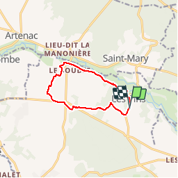

Length
9.6 km

Max alt
133 m

Uphill gradient
118 m
Km-Effort
11.2 km

Min alt
84 m

Downhill gradient
119 m
Boucle
Yes
Creation date :
2018-11-29 13:31:57.717
Updated on :
2018-11-29 16:04:47.474
2h31
Difficulty : Easy

FREE GPS app for hiking
 SityTrail
IGN / Geographical institutes
SityTrail Plus
The world is yours!
About
Trail Walking of 9.6 km to be discovered at New Aquitaine, Charente, Les Pins. This trail is proposed by alainjoseph6.
Description
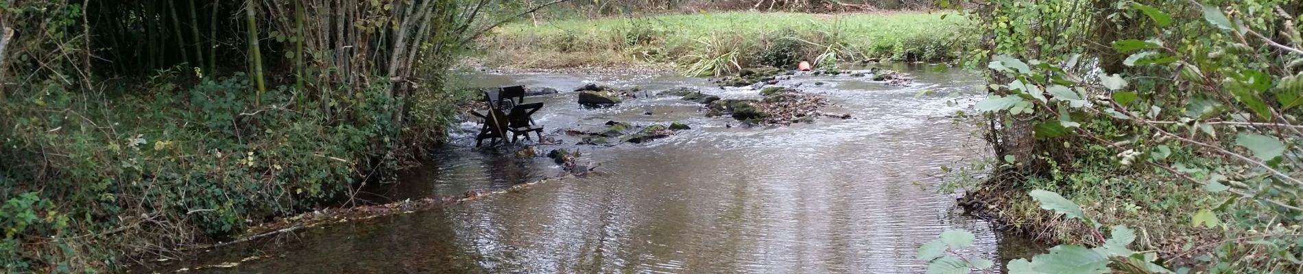
Une belle randonnée en suivant la Bonnieure où l'ont découvre de nombreux moulins.
Photos


Positioning
Country:
France
Region :
New Aquitaine
Department/Province :
Charente
Municipality :
Les Pins
Location:
Unknown
Start:(Dec)
Start:(UTM)
297269 ; 5076887 (31T) N.
Comments